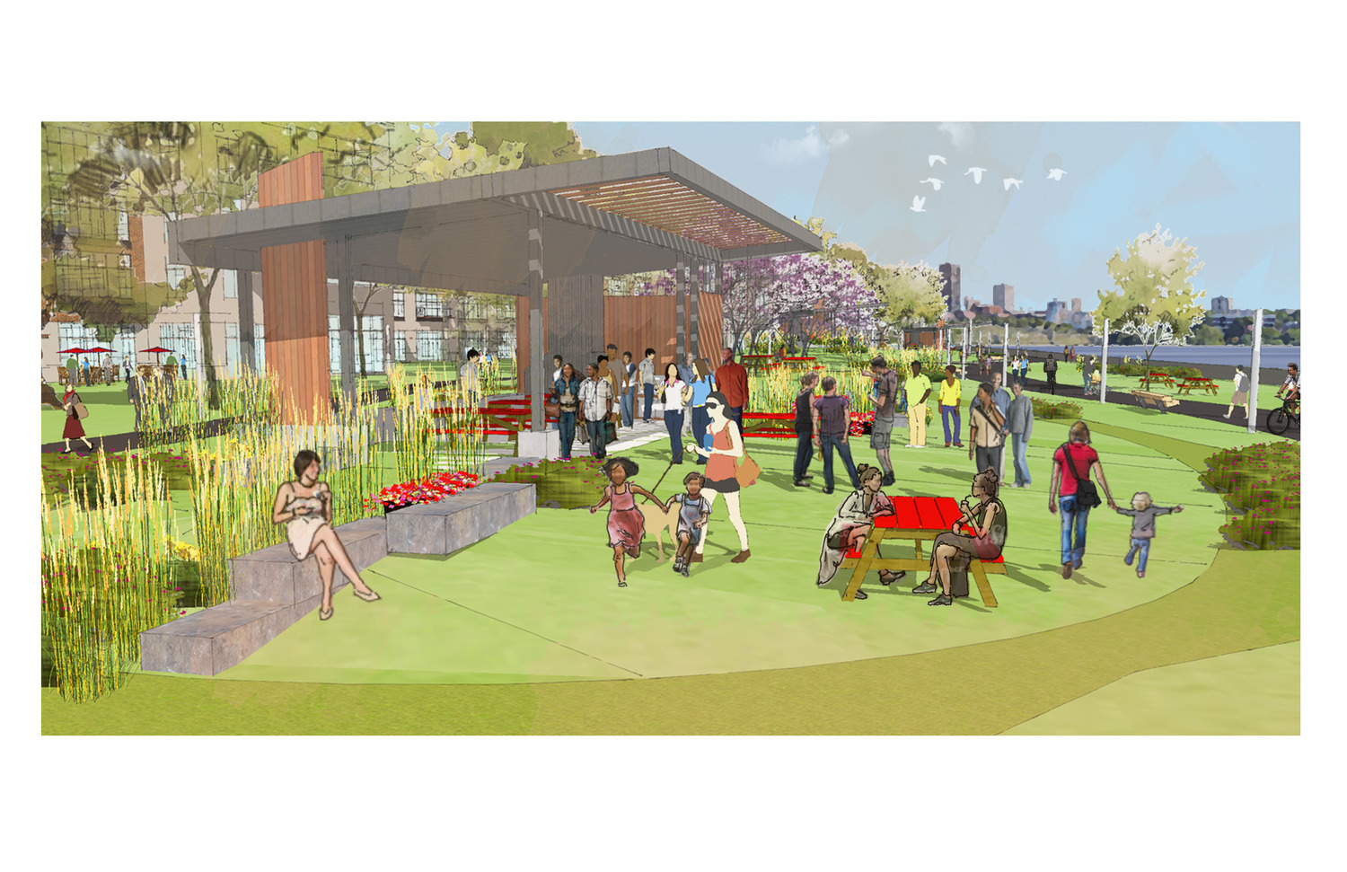
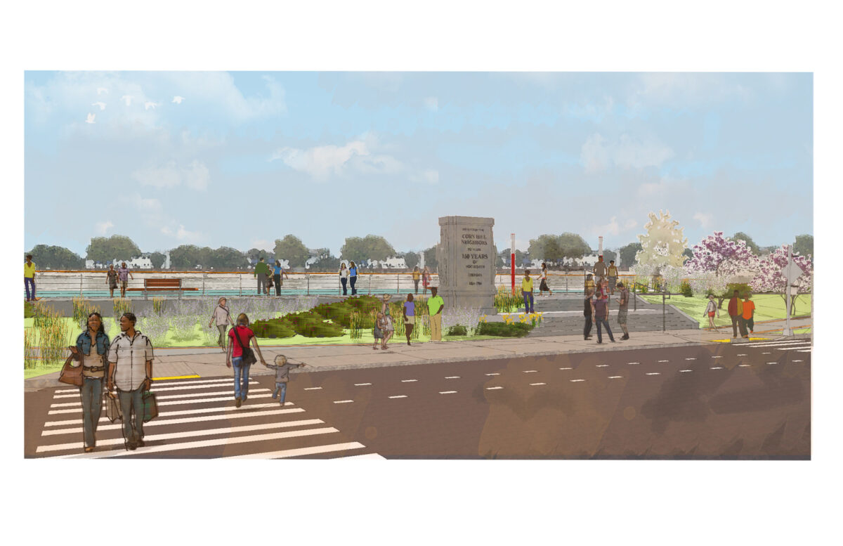
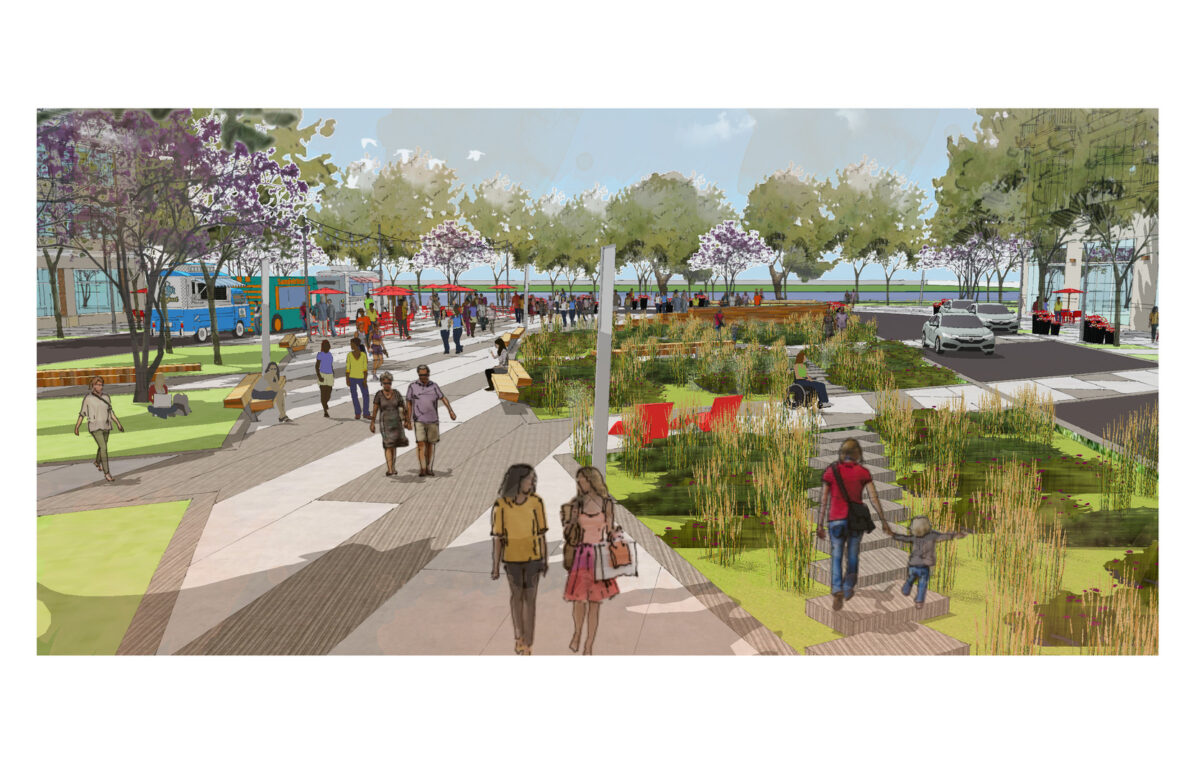
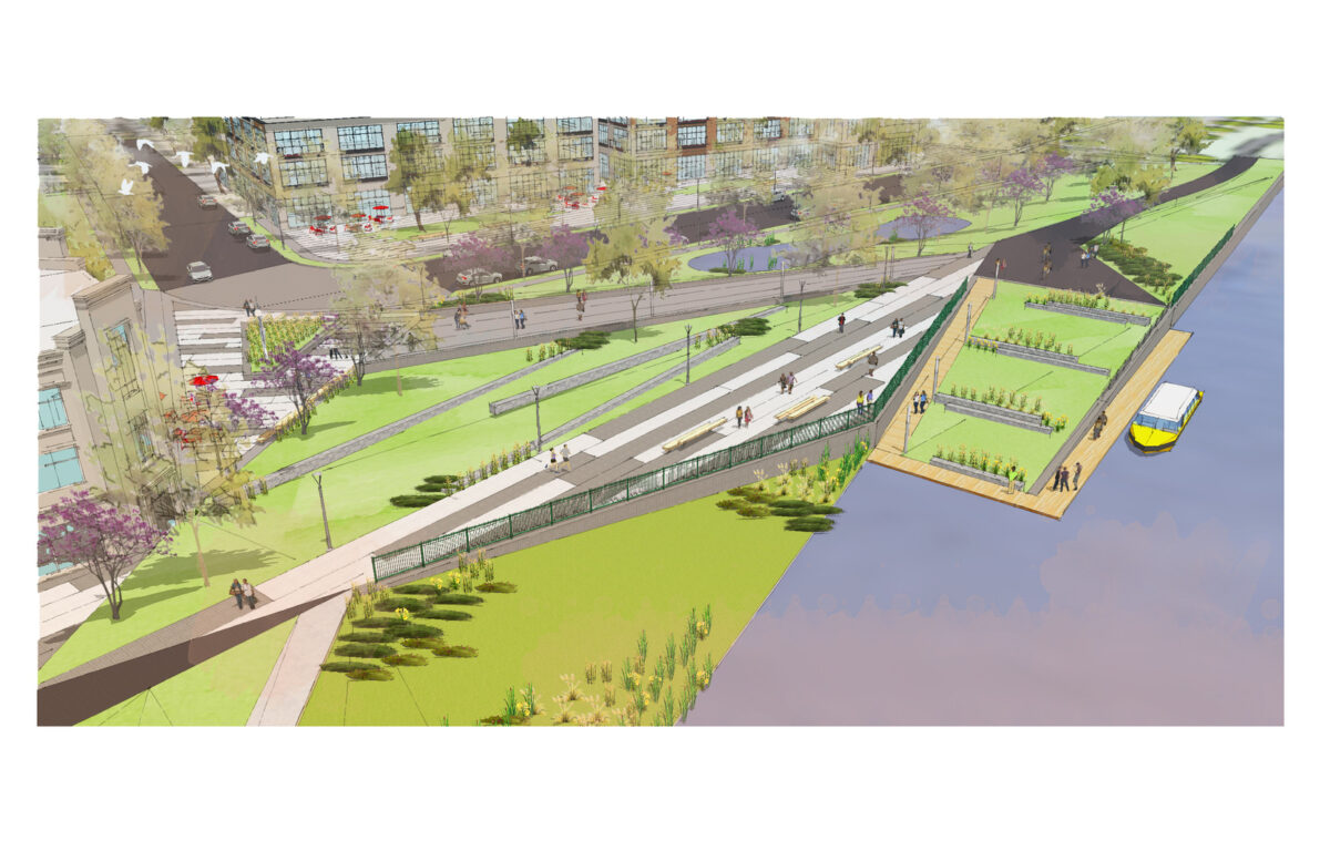
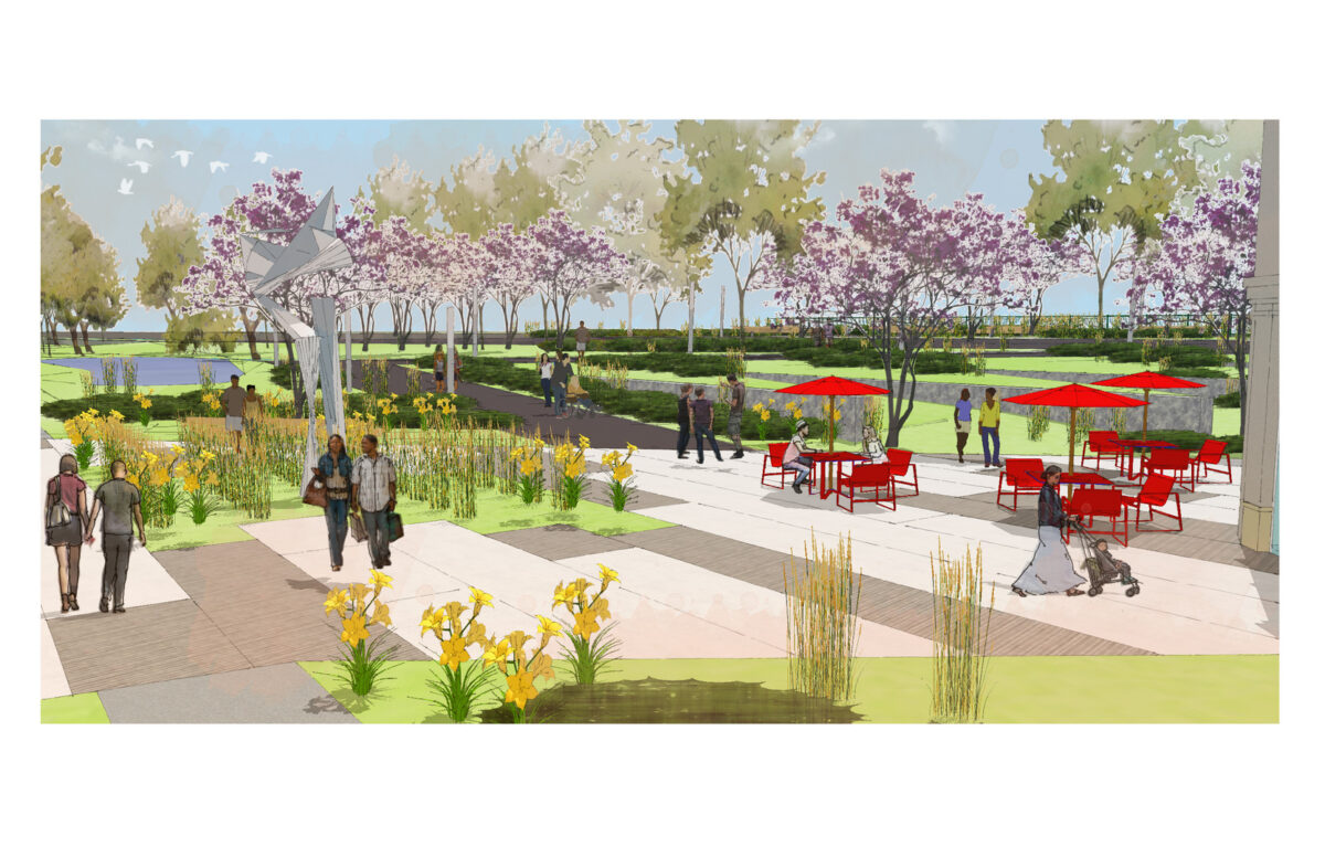
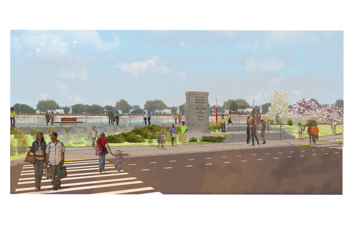
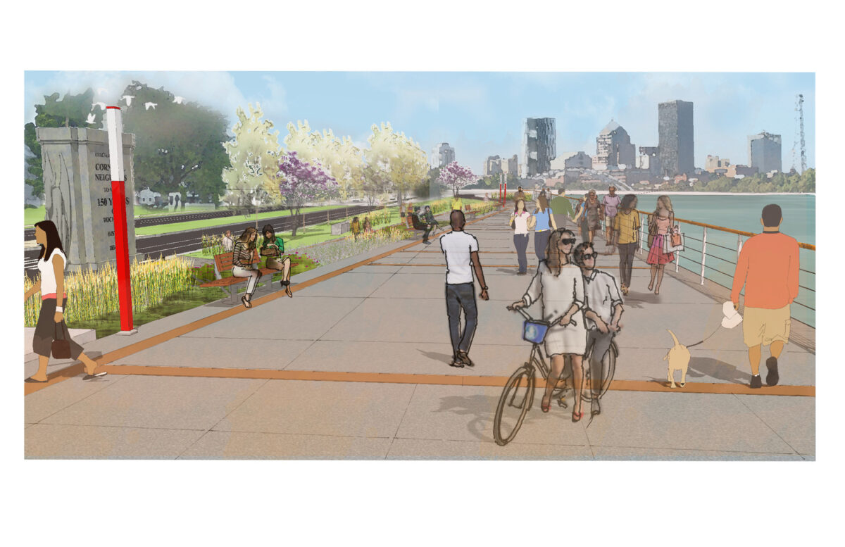
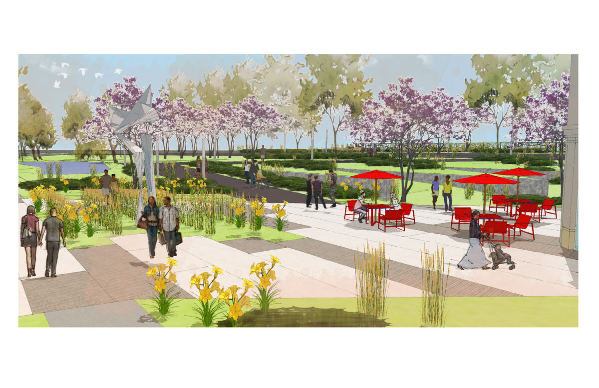
Tucked between the Corn Hill historic district and the growing Brooks Landing corridor, a stretch of Rochester’s South Genesee riverfront holds enormous untapped potential. Strategically positioned just across the river from the University of Rochester, the area’s proximity to mixed-use development, student housing, and hospitality investment makes it a natural candidate for transformation. Yet for years, large blighted brownfield sites have defined the landscape, remnants of an industrial past that no longer reflects the future this community is building toward.
A Plan Built on Trust
The City of Rochester engaged our team to lead a neighborhood-based planning effort focused on practical, community-driven strategies to reimagine the corridor as a vibrant mixed-use district. From the outset, the process was designed around the people it would impact most. Visioning workshops, design charrettes, stakeholder meetings, and neighborhood outreach events gave residents and local partners a meaningful seat at the table at every milestone. That commitment to transparency and collaboration helped build the consensus needed to move from conversation to action.
From Industrial Legacy to Lasting Opportunity
Through an inclusive, iterative approach, the resulting plan charts a clear path forward, guiding the area’s evolution from industrial decline to a revitalized waterfront neighborhood. By aligning community values with strategic positioning, the vision creates a framework for long-term investment, equitable growth, and a more resilient connection between Rochester’s residents and its riverfront.