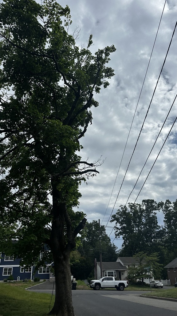
Whether it was planted back in the 1960s or as recently as 2016, a single tree along a busy neighborhood street has a lot of history. It has grown through scorching summers, weathered a hurricane or two, and stood tall against freezing winters. But today, that same tree might be looming on the edge of becoming a hazard to drivers and pedestrians from reaching the end of its normal life cycle, being damaged or even growing too close to power lines.
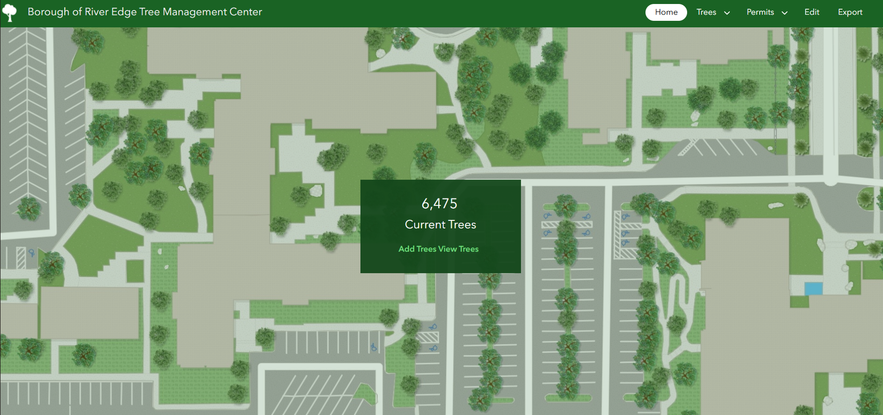
This is why keeping a precise inventory and condition of community trees is so critical for local governments. To make that daunting task seamless, the GIS experts at Colliers Engineering & Design are giving municipalities the advanced tools they need to track, manage, and secure their urban forests effortlessly.
New Regulations
Trees provide aesthetic character to a town, promote clean air quality, and their roots help with stormwater management. But these important plants now need to be managed in accordance with New Jersey’s recently adopted MS4 Permit, NJDEP’s Stormwater Management and Tree Removal/Replacement regulation.
As a result, municipalities regulated under the Tier A permit are required to adopt the regulation, which essentially means if they remove a tree, they need to plant a replacement. The mandate further established rules for mitigating stormwater runoff, reducing soil erosion, and protecting the state’s water cycle. It applies to both public and private property owners, requiring tree replacement based on size, with fines and withheld Certificates of Occupancy as enforcement tools. Why control stormwater? When it flows excessively over pavement, roofs, and other surfaces, it collects pollutants like oil and fertilizers, transporting them into waterways. The Tree Removal and Replacement Ordinance benefits communities because it seeks to mitigate stormwater runoff, reduce soil erosion, and protect the state’s water cycle.
Proactive Approach
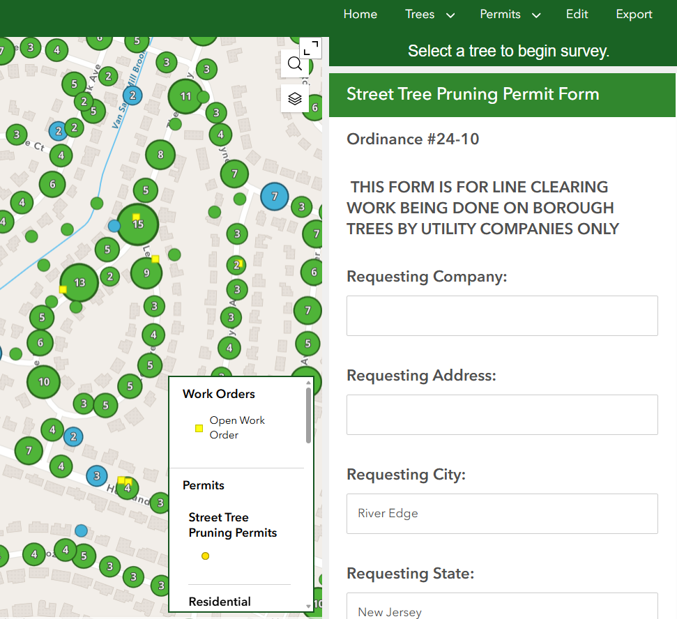
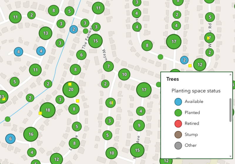
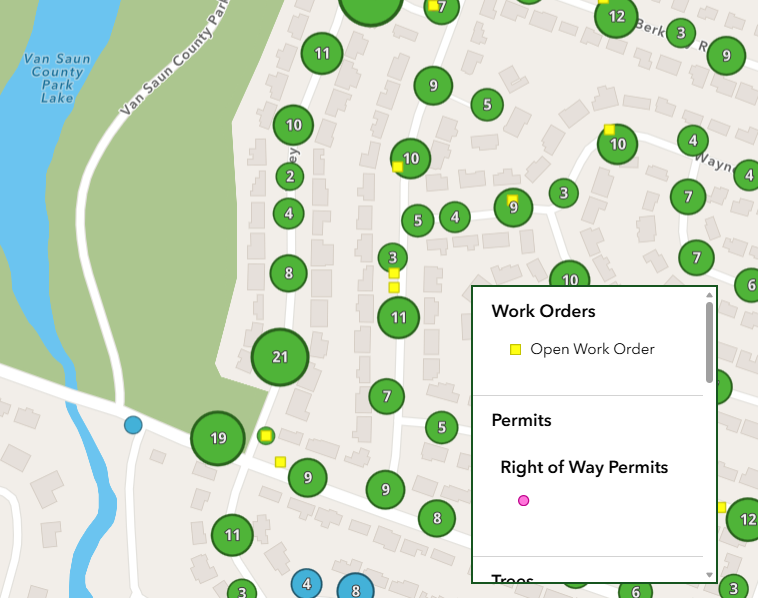
Given this law, our GIS team knew that municipalities in NJ would need a streamlined way to keep track of their trees; But they didn’t stop there. They anticipated that clients would also want to be able to manage which trees need or have work orders, which ones are where in the permitting process, the status of the space, whether a former tree is now a stump, and more.
“The moment this regulation came out, we thought about it from every angle. If a tree is being removed, a permit is needed in order to do that. It only makes sense to address everything including permits and work orders in one place,” explained Nick Coughlin, ENV SP, GIS Assistant Project Manager.
“Our team proactively performed research and development to provide a solution that could do that for our clients. Existing client River Edge was the first town to benefit from the program,” he added.
A Customized Product
River Edge Borough realized they needed a smarter way to manage their stormwater infrastructure and tree inventory. After we first created an MS4 stormwater management application for them in 2023, in 2024 the Borough asked us to develop one specifically for their tree management too.
GIS Technician Lauren Mayers, who built the app, explained, “A lot of care was taken by our team to ensure the Borough felt comfortable making this change. We had continuous communication with them, and learned about their specific workflow, goals, and needs. This app was never something we wanted to make generically and then sell indiscriminately to every town.”
Perhaps the biggest challenge was integrating River Edge’s legacy data and existing inventory into our system.
“Migrating historical data and all of their documentation, their past work orders and pictures, into this system was a challenge at first because the databases they came from weren’t the same format, but integrating data from other platforms is something that GIS is particularly good at. In the end, the new program was able to consume all the legacy data from past products,” Lauren explained.
The Impact on River Edge
The custom mobile and desktop application was rolled out for testing in summer 2025 and finalized in 2026. Because Lauren customized the application to display tools they were familiar with, the transition was essentially seamless. Their Department of Public Works has integrated it into their
field and office operations to manage tree sites, planting status, permits, documents, work orders, and more. With the new application, they easily completed their inventory of trees within their rights-of-way.
“We did the stormwater data collection, which serves a DEP regulation, and have it housed in the township’s Esri AGOL account, another application that can be coupled to share data with the tree management app,” shared Nick. “The view is interchangeable, and you can see that data in layers. You can see them altogether, or isolated. Now the town is saving money by only paying one subscription fee annually for software instead of multiple, because it’s all under the same license. This is very different from off-the-shelf products out there.”
River Edge now manages our stormwater compliance and tree program with a tool tailored to the Borough’s daily workflows, and tree management has become straightforward.
Endless Potential
“This application is interchangeable. While the current version is spot on for this specific regulation and town, it certainly could be configured or enhanced as time goes on,” explained GIS Discipline Leader Suzanne Zitzman, GISP. “We can also create versions of this for other states, either because of mandates that may arise, or because a municipality sees a need and wants to preemptively address it.”
The GIS team looks forward to developing future versions of the application for other towns nationwide, and even developing Story Maps for the public to learn more about how the towns are managing the trees they see every day.